Port St. Lucie, Florida
| The City of Port St. Lucie, Florida | |
|---|---|
| — City — | |
 |
|
| Nickname(s): PSL | |
| Motto: A City for All Ages | |
 |
|
 |
|
| Coordinates: | |
| Country | |
| State | |
| County | St. Lucie |
| Incorporated | April 27, 1961 |
| Government | |
| - Mayor | Patricia Christensen |
| Area | |
| - City | 76.7 sq mi (198.6 km2) |
| - Land | 75.5 sq mi (195.6 km2) |
| - Water | 1.1 sq mi (3.0 km2) |
| Elevation | 16 ft (5 m) |
| Population (2009)[1][2] | |
| - City | 155,251 |
| - Density | 2,056/sq mi (794/km2) |
| - Metro | 406,296 |
| Time zone | Eastern (EST) (UTC-5) |
| - Summer (DST) | EDT (UTC-4) |
| FIPS code | 12-58715[3] |
| GNIS feature ID | 0308089[4] |
| Website | [1] |
Port St. Lucie is a city in St. Lucie County, Florida, United States. The population of Port St. Lucie was 88,769 at the 2000 census but grew rapidly during the 2000s. In 2009 the State of Florida estimated the City's population at 155,251[1]. Port St. Lucie forms part of a metropolitan area called the Port St. Lucie, Florida Metropolitan Statistical Area that in 2009 was estimated to have 406,296 residents.[2]
Contents |
History
Port Saint Lucie was a largely uninhabited tract of land south of White City, Florida in the 1950s, composed of a fishing camp, a few farms and businesses near US1. In 1958, with a budget of $50 million, the General Development Corporation (GDC) purchased the River Park development and 40,000 acres along the North Fork of the St. Lucie River.[5] In 1959, the GDC opened its first bridge over the St. Lucie River, allowing for direct automobile access to Port St. Lucie.
By February 25, 1961 there were 250 homes in the new city. GDC requested the state legislature to incorporate 70 miles along with the River Park settlement into the City of Port St. Lucie. River Park did not incorporate into the city at the request of its residents. Port St. Lucie became a city on April 27, 1961 with the passage of House Bill No. 953, proposed by State Representative Rupert Smith and approved by Florida Governor C. Farris Bryant.[6]
In the early 1990s, Core Communities (CC), acquired, and began planning on what would become St. Lucie West. Originally, St. Lucie West was planned to have contained about 14,000 homes over a 20-year period on 7 square miles. But after realizing the communities strategic position, they began developing it into more than just a residential area. CC began building business sectors and places where people could have fun. That resulted in 7,000 jobs being brought to the small town, helping it into its boom during most of the early 2000s.[7]
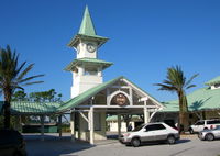
In 2006, CC, yet again, started development of its newest community, Tradition. The community, which sat west of the Interstate 95 intersection of Gatlin Blvd., was a large cattle ranch, before CC began to develop it. There they built around 13 million square feet of commercial area, and room for over 18,000 residences. According to CC's website, Tradition is the largest fully-entitled residential development area from the tip of Interstate 95 to the Canadian Border. It has been advertised as the town you grew up in, modeled after a 1950s-era town. According to its website, Tradition Square, the town center of the community, holds year long festivities. It was also chosen as the site of HGTV's Green Home 2009, and one of America's best 100 communities.[7]
In 2007, the housing market began to collapse and unemployment started to rise. As of February 2009, unemployment was at 10 1/2 percent and in 2008, nearly 11,000 homes went into foreclosure. This has prompted the county government to consider declaring itself a disaster area. Doing so would give county administrators access to $17 million in county emergency reserve funds. That money, combined with a transportation fund and other accounts, would give St. Lucie $20 million or $30 million to spend on building projects: research parks, highways and other infrastructure improvements.[8]
In 2008, Tradition and CC welcomed the Florida Center of Innovation, a research laboratory and campus, which has a building in Tradition for two biotech and life science companies, the Torrey Pines Institute for Molecular Studies and the Vaccine & Gene Therapy Institute. This campus alone is predicted to bring over 30,000 jobs to the city of Port St. Lucie, alone.[7]
Demographics
As of the census[3] of 2000, there were 88,769 people, 33,909 households, and 25,736 families residing in the city. The population density was 1,175.1 people per square mile (453.7/km²). There were 36,785 housing units at an average density of 487.0/sq mi (188.0/km²). The racial makeup of the city was 87.88% White, 7.09% African American, 1.24% Asian, 0.23% Native American, 0.03% Pacific Islander, 1.77% from other races, and 1.76% from two or more races. Hispanic or Latino of any race were 7.52% of the population.
There were 33,909 households out of which 31.6% had children under the age of 18 living with them, 61.8% were married couples living together, 10.0% had a female householder with no husband present, and 24.1% were non-families. 18.2% of all households were made up of individuals and 8.9% had someone living alone who was 65 years of age or older. The average household size was 2.60 and the average family size was 2.94.
In the city the population was spread out with 24.3% under the age of 18, 5.9% from 18 to 24, 28.1% from 25 to 44, 22.8% from 45 to 64, and 18.8% who were 65 years of age or older. The median age was 40 years. For every 100 females there were 94.5 males. For every 100 females age 18 and over, there were 91.4 males.
The median income for a household in the city was $40,509, and the median income for a family was $44,162. Males had a median income of $18,730 versus $16,702 for females. The per capita income for the city was $18,059. About 15.7% of families and 17.9% of the population were below the poverty line, including 11.1% of those under age 18 and 9.8% of those age 65 or over.
The State of Florida estimated that Port St. Lucie's population had reached 155,251 as of April 2009.[1]
Geography
(27.275772, -80.355029).[9]
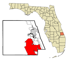
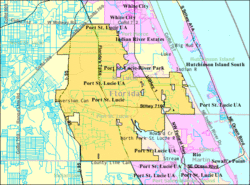
Port St. Lucie is located north of the St. Lucie Fork River, and south of Fort Pierce, FL. To its east is the Atlantic Ocean. According to the Köppen climate classification, Port St. Lucie falls under a Tropical Monsoon Climate .
According to the United States Census Bureau, the city has a total area of 76.7 square miles (198.6 km²), of which, 75.5 square miles (195.6 km²) is land and 1.1 square miles (3.0 km²) (1.50%) is water.
Climate
Summers are usually hot, with temperatures averaging low 90s. Winters are usually mild to warm, with average temperatures around 70s°F. The average yearly precipitation is around 53.5 in.[10].
Port St. Lucie was hit directly by Hurricane Frances (as a Category 2 hurricane) on September 4, 2004, and by Hurricane Jeanne (as a Category 3 hurricane) on September 25, 2004. On October 24, 2005 Port St. Lucie was hit directly by Hurricane Wilma (as a Category 3 hurricane).
| Climate data for Port Saint Lucie, Florida | |||||||||||||
|---|---|---|---|---|---|---|---|---|---|---|---|---|---|
| Month | Jan | Feb | Mar | Apr | May | Jun | Jul | Aug | Sep | Oct | Nov | Dec | Year |
| Source: Weather Channel[11] | |||||||||||||
Major highways
![]() Florida's Turnpike is the only toll road in St. Lucie County, which is the northernmost place where the Turnpike and Interstate 95 run close to each other. The Turnpike has 2 exits within Port St. Lucie's city limits: Port St. Lucie Boulevard (SR 716) and Becker Road. For most of its route through St. Lucie County, the Turnpike is east of I-95. The Turnpike provides access to Orlando to the north, and Miami to the south.
Florida's Turnpike is the only toll road in St. Lucie County, which is the northernmost place where the Turnpike and Interstate 95 run close to each other. The Turnpike has 2 exits within Port St. Lucie's city limits: Port St. Lucie Boulevard (SR 716) and Becker Road. For most of its route through St. Lucie County, the Turnpike is east of I-95. The Turnpike provides access to Orlando to the north, and Miami to the south.
![]() Interstate 95 is in the western portion of the city. It is 6 lanes wide (3 in each direction), and provides access to Miami and Jacksonville. Exits include exit 126 (Midway Road), exit 121 (St. Lucie West Blvd.), exit 120 (Crosstown Parkway), exit 118 (Gatlin Blvd./Tradition Pkwy.), and exit 114 (Becker Rd.)[12].
Interstate 95 is in the western portion of the city. It is 6 lanes wide (3 in each direction), and provides access to Miami and Jacksonville. Exits include exit 126 (Midway Road), exit 121 (St. Lucie West Blvd.), exit 120 (Crosstown Parkway), exit 118 (Gatlin Blvd./Tradition Pkwy.), and exit 114 (Becker Rd.)[12].
Transportation
Port St. Lucie is served by Community Transit, a division of Aging of St. Lucie, Inc. The original bus system started out as a demand response service bus in the 1990s, it only served St. Lucie County. Soon it expanded to a fixed route system, going to predetermined locations along a route. On June 3, 2002, the Florida Department of Transportation (FDOT) approved funding, expanding the bus service to Martin County, and became the Treasure Coast Connector.[13]
Sports

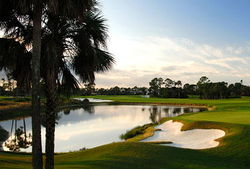
The city is home to New York Mets spring training and the St. Lucie Mets Florida State League team. They both play at Digital Domain Field. The Treasure Coast Galleons, a semi-pro soccer team also calls Port St. Lucie its home. Florida Atlantic University has its Treasure Coast campus in the city. There is a golf complex, the PGA Village with 54 holes of golf, a learning center and a historical center. The city also hosted the Ginn Classic at Tesoro, the city's first ever PGA Tour Event, in 2007.[14] Port St Lucie is the home of world renowned Mixed Martial Arts school, American Top Team Port St Lucie campus. Port St. Lucie is also home to Local Skate Team. Port St. Lucie is also the home of the 2009 National Champions in Pop Warner Football Pop Warner Little Scholars. The Jr. Midget team (10- 13 year olds) went 16 - 0 en route to winning the Pop Warner Super Bowl at Disney's Wide World of Sports Complex. 2009 Pop Warner Super Bowl
Education
Port St. Lucie is served by St. Lucie County Public Schools, which is a school district which serves the rest of St. Lucie County, FL. In Port St. Lucie, there are 6 Elementary Schools, 7 K-8 Schools, 3 High Schools, and 4 Institutions of Higher Education. The three High Schools in Port St. Lucie are Port St. Lucie High School, St. Lucie West Centennial High School, and Treasure Coast High School. The 4 Higher Education Institution centers operated in Port St. Lucie are Indian River State College, which shares its campus with Florida Atlantic University, Barry University, and Keiser University.
Government
City Council
- Mayor Patricia Christensen
- Vice Mayor Jack Kelly-District 4
- Councilwoman Michelle Berger-District 2
- Councilman Christopher Cooper-District 3
- Councilwoman Linda Bartz-District 1
City Manager'
- Giodani LaFlotte
Assistant City Manager/CRA Director
- Greg Oravec
Chief of police
- Donald L Shinnamon[15]
City Engineer
- Frank Wholigon
Notable residents
- Megan Fox, American Actress
- VersaEmerge, American Pop Rock band
- Din Thomas, UFC Fighter
- Mario Bencastro, Salvadorian novelist
- Vanilla Ice, Hip-Hop Artist
- Rick Ankiel, Professional Baseball Player
- Zachary Herold, Professional Soccer Player
- Chris Levesque, Former guitarist for A Wilhelm Scream from New Bedford, MA attended high school in Port St. Lucie.
- Wayne Huizenga, American businessman who grew Blockbuster Video, Waste Management, Inc., and AutoNation into successful companies.
References
- ↑ 1.0 1.1 1.2 State of Florida Office of Economic and Demographic Research, 2009
- ↑ 2.0 2.1 http://www.census.gov/popest/metro/metro.html Metropolitan and micropolitan statistical area population and estimated components of change: April 1, 2000 to July 1, 2009
- ↑ 3.0 3.1 "American FactFinder". United States Census Bureau. http://factfinder.census.gov. Retrieved 2008-01-31.
- ↑ "US Board on Geographic Names". United States Geological Survey. 2007-10-25. http://geonames.usgs.gov. Retrieved 2008-01-31.
- ↑ http://www.portstluciehistoricalsociety.org/pslhistory2.htm
- ↑ http://www.portstluciehistoricalsociety.org
- ↑ 7.0 7.1 7.2 http://www.corecommunities.com/the-core-story/
- ↑ http://www.npr.org/templates/story/story.php?storyId=100824167
- ↑ "US Gazetteer files: 2000 and 1990". United States Census Bureau. 2005-05-03. http://www.census.gov/geo/www/gazetteer/gazette.html. Retrieved 2008-01-31.
- ↑ http://www.weather.com/weather/wxclimatology/monthly/graph/34986?from=36hr_bottomnav_undeclared
- ↑ "Average Weather for Port Saint Lucie, FL - Temperature and Precipitation". http://www.weather.com/weather/wxclimatology/monthly/graph/34986?from=36hr_bottomnav_undeclared. Retrieved 8 April 2009.
- ↑ http://www.tcpalm.com/news/2009/jul/31/becker-road-interchange-will-make-things-easier/
- ↑ http://www.treasurecoastconnector.com/about/
- ↑ PGATOUR.COM - Ginn Resorts to host PGA TOUR event
- ↑ http://www.tcpalm.com/news/2008/nov/26/port-st-lucie-selects-citys-next-police-chief/
External links
- City of Port St. Lucie
- St. Lucie County Chamber of Commerce
- Port St. Lucie, Fla., is Fastest-Growing City, from the Census Bureau website
- Port St. Lucie Historical Society
|
|||||||||||||||||
|
||||||||||||||||||||
|
|||||||||||||
